
High Altitude Lightning Detection Satellite
The view from 104,000 feet above sea level, captured by the GoPro integrated in our satellite.
In the Fall 2019 ASEN 1400 class, my projects team was tasked with designing an experiment and a satellite that would fly to 100,000 feet above the Earth.

Goals
Launch satellite to 100,000 feet above sea level on a high altitude weather balloon
Record Very Low Frequency radio waves emitted from lightning strikes
Measure temperature, pressure, humidity, and acceleration for the duration of the flight
Maintain an internal temperature of above -10°C
Weight shall not exceed 800g
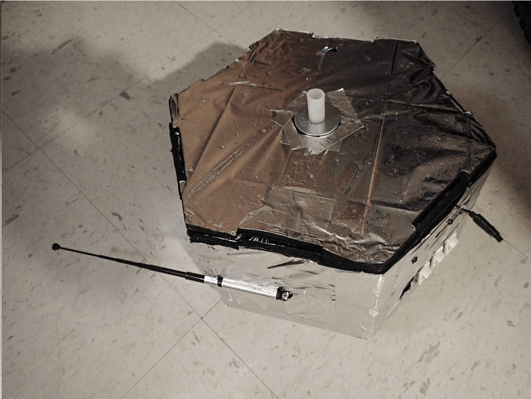
Design & Hardware
CAD assembly in Inventor
Hexagonal body to conserve area
Constructed from foam board and mylar thermal blankets to conserve weight and heat
Electronics
Antenna, custom PCB, Arduino Uno, and OpenLog served as VLF radio receiver
Custom PCB designed on Eagle and printed at CU ITLL
Second Arduino Uno utilized for temperature, humidity, pressure, acceleration sensor, and heating pads
Powered by LiPo batteries
GoPro HERO 4


My Contributions
Programmed temperature, humidity, pressure, acceleration sensors
Programmed heating pad to turn on when internal temperatures reached 5°C
Processed VLF receiver and sensor data in Matlab
Team scheduling and design documentation
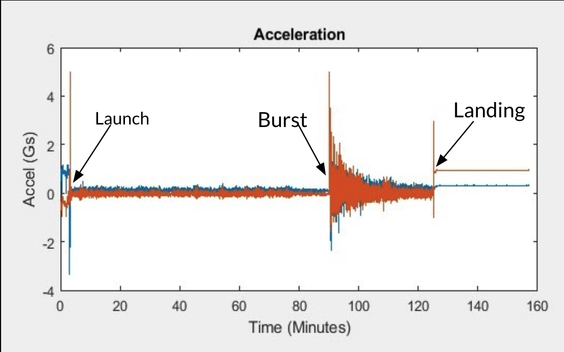
Launch Day & Flight


Results
Satellite reached an altitude of 104,023 feet
All sensors functioned as expected
Arduino Uno and OpenLog did not sample radio waves at a high enough rate
After flight, the VLF receiver was reconfigured with Teensy 3.6 and flash chip to be ready for a second flight


Expected data from tests (lightning strikes are the vertical lines)
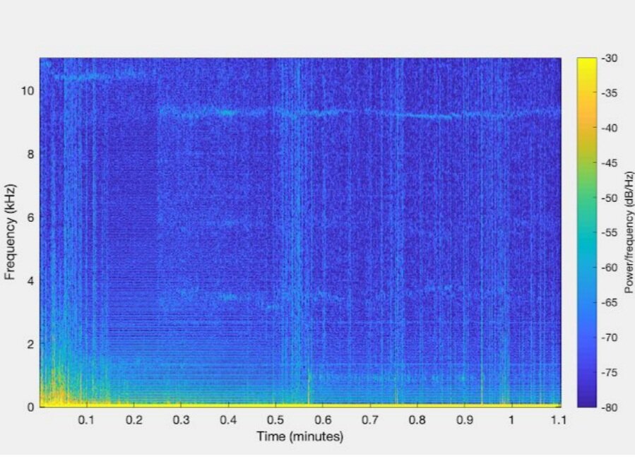
Data from flight was not sampled at a high enough rate